fwapgr is an R package that uses the fwapg API to query the Freshwater Atlas (FWA) of British Columbia (BC). The functions and arguments in fwapgr match those available in the API.
If you are looking for a higher-level R package to query the FWA of BC see fwatlasbc which wraps fwapgr.
Installation
To install the lastest version from GitHub
# install.packages("devtools")
devtools::install_github("poissonconsulting/pgfeatureserv")
devtools::install_github("poissonconsulting/fwapgr")
Introduction
fwapgr allows you to perform three types of operation.
Get Information on Collections
Get information about the collections or a collection’s properties:
Execute Spatial Functions
Execute spatial functions:
Demonstration
Get Sangan River from whse_basemapping.fwa_stream_networks_sp collection:
coll <- "whse_basemapping.fwa_stream_networks_sp"
river <- fwapgr::fwa_query_collection(coll, filter = list(gnis_name = "Sangan River"))
river
#> Simple feature collection with 21 features and 26 fields
#> Geometry type: LINESTRING
#> Dimension: XYZ
#> Bounding box: xmin: -131.9972 ymin: 53.94994 xmax: -131.9168 ymax: 54.0332
#> z_range: zmin: 1 zmax: 67
#> Geodetic CRS: WGS 84
#> # A data frame: 21 × 27
#> blue_line_key blue_line_key_50k downstream_route_mea…¹ edge_type feature_code
#> * <int> <int> <dbl> <dbl> <chr>
#> 1 360879896 11 6808. 1000 GA24850000
#> 2 360879896 11 12161. 1000 GA24850000
#> 3 360879896 11 9544. 1000 GA24850000
#> 4 360879896 11 10909. 1000 GA24850000
#> 5 360879896 11 1266. 1000 GA24850000
#> 6 360879896 11 13068. 1000 GA24850000
#> 7 360879896 11 8744. 1000 GA24850000
#> 8 360879896 11 13776. 1000 GA24850000
#> 9 360879896 11 7849. 1000 GA24850000
#> 10 360879896 11 5029. 1000 GA24850000
#> # ℹ 11 more rows
#> # ℹ abbreviated name: ¹downstream_route_measure
#> # ℹ 22 more variables: feature_source <chr>, fwa_watershed_code <chr>,
#> # gnis_id <int>, gnis_name <chr>, gradient <dbl>, left_right_tributary <chr>,
#> # length_metre <dbl>, linear_feature_id <int>, local_watershed_code <chr>,
#> # localcode_ltree <chr>, stream_magnitude <dbl>, stream_order <dbl>,
#> # upstream_route_measure <dbl>, waterbody_key <chr>, …Get simplified Yakoun River watershed starting 10km upstream:
blk <- river$blue_line_key[1]
wshed <- fwapgr::fwa_watershed_at_measure(
  blk,
  downstream_route_measure = 10000,
  transform = c("ST_Simplify", 2000)
)
ggplot2::ggplot() +
  ggplot2::geom_sf(data = wshed, lwd = 0.15, fill = "steelblue", alpha = 0.5) +
  ggplot2::geom_sf(data = river, lwd = 0.15)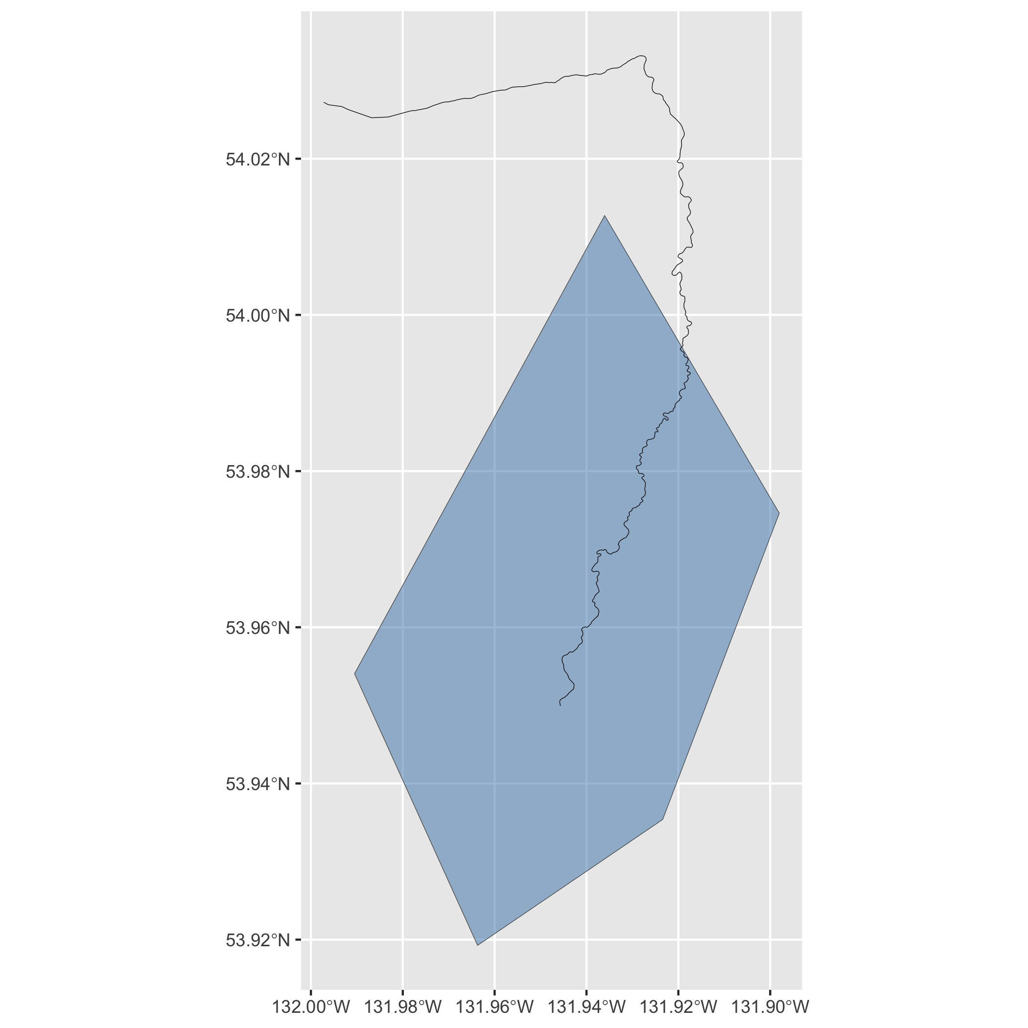
Creditation
fwapgr relies on fwapg API which is created, maintained and hosted by Simon Norris at Hillcrest Geographics.
Contribution
Please report any issues.
Pull requests are always welcome.
Code of Conduct
Please note that fwapgr is released with a Contributor Code of Conduct. By contributing to this project, you agree to abide by its terms.